
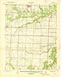
1939 Map of Metz
USGS Topo · Published 1939About this map
Metz and Rinehart anchor this Vernon County landscape as it appeared just before the Second World War. The area is defined by the winding course of the Little Osage River and the Marmaton River, which create a complex system of drainage across the townships of Metz and Washington. The Missouri Pacific railroad cuts a diagonal path through the northern half of the sheet, providing a vital link for these rural communities.
Find a feature on this map
38 named features on this map. Tap any name to fly to it.
Don’t see what you’re looking for? This feature index may not catch every label — zoom into the map to look around manually.
Map Details
Editions of this 1939 Metz Map
2 editions found
Other maps of this area

1884 · Fort Scott
USGS Topo · 1:125,000

1886 · Nevada
USGS Topo · 1:125,000

1886 · Fort Scott
USGS Topo · 1:125,000

1887 · Butler
USGS Topo · 1:125,000

1887 · Mound City
USGS Topo · 1:125,000

1893 · Fort Scott
USGS Topo · 1:125,000

1893 · Mound City
USGS Topo · 1:125,000

1894 · Butler
USGS Topo · 1:125,000

1894 · Nevada
USGS Topo · 1:125,000

1933 · Camp Clark
USGS Topo · 1:24,000