
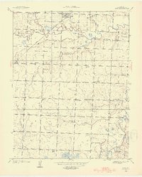
1938 Map of Metz
USGS Topo · Published 1954About this map
Metz serves as the primary hub in this late 1930s landscape, situated just north of the meandering Little Osage River. The Missouri Pacific railroad cuts through the northern section of the map, providing a vital transport link for this agricultural pocket of Vernon County. The region is densely populated with small-scale rural institutions, from Old Metz Sch to the Prairie Dell Ch, suggesting a tightly knit network of farming communities.
Find a feature on this map
35 named features on this map. Tap any name to fly to it.
Don’t see what you’re looking for? This feature index may not catch every label — zoom into the map to look around manually.
Map Details
Editions of this 1938 Metz Map
2 editions found
Other maps of this area

1884 · Fort Scott
USGS Topo · 1:125,000

1886 · Nevada
USGS Topo · 1:125,000

1886 · Fort Scott
USGS Topo · 1:125,000

1887 · Butler
USGS Topo · 1:125,000

1887 · Mound City
USGS Topo · 1:125,000

1893 · Fort Scott
USGS Topo · 1:125,000

1893 · Mound City
USGS Topo · 1:125,000

1894 · Butler
USGS Topo · 1:125,000

1894 · Nevada
USGS Topo · 1:125,000

1933 · Camp Clark
USGS Topo · 1:24,000