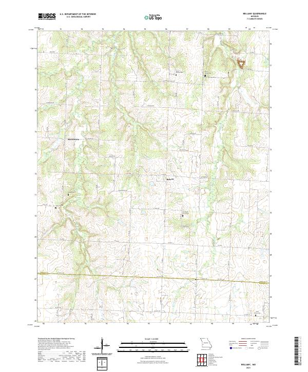
2021 Map of Bellamy
USGS Topo · Published 2021About this map
Bellamy and Rousertown anchor this rural landscape in southern Vernon County, where the topography is defined by a dense network of waterways including Clear Cr, Walnut Cr, and McCarty Cr. The settlement pattern reflects a long-established agricultural community, evidenced by numerous small family and community burial grounds such as Olive Branch Cem, Arbor Grove Cem, and Tolson Cem. The section-line road grid, featuring routes like Veteran Rd and Waldo Rd, bisects the creek valleys and connects these small hubs. The southern portion of the survey crosses the boundary from Vernon into Barton County near Saint James Cem, showing the continuity of the landscape across administrative lines. This 2021 update documents the modern road network, including E DD Hwy and E B Hwy, while preserving the locations of legacy landmarks essential for local genealogical research.
Find a feature on this map
41 named features on this map. Tap any name to fly to it.
Don’t see what you’re looking for? This feature index may not catch every label — zoom into the map to look around manually.
Map Details
Editions of this 2021 Bellamy Map
This is the sole edition of this map. No revisions or reprints were ever made.
Other maps of this area

1886 · Nevada
USGS Topo · 1:125,000

1894 · Nevada
USGS Topo · 1:125,000

1933 · Camp Clark
USGS Topo · 1:24,000

1939 · Dederick
USGS Topo · 1:24,000

1939 · Eldorado Springs South
USGS Topo · 1:24,000
1942 · Dederick
USGS Topo · 1:24,000
1942 · Eldorado Springs South
USGS Topo · 1:24,000

1947 · Joplin
USGS Topo · 1:250,000
1948 · Nevada
USGS Topo · 1:24,000

1949 · Joplin
USGS Topo · 1:250,000