Loading...
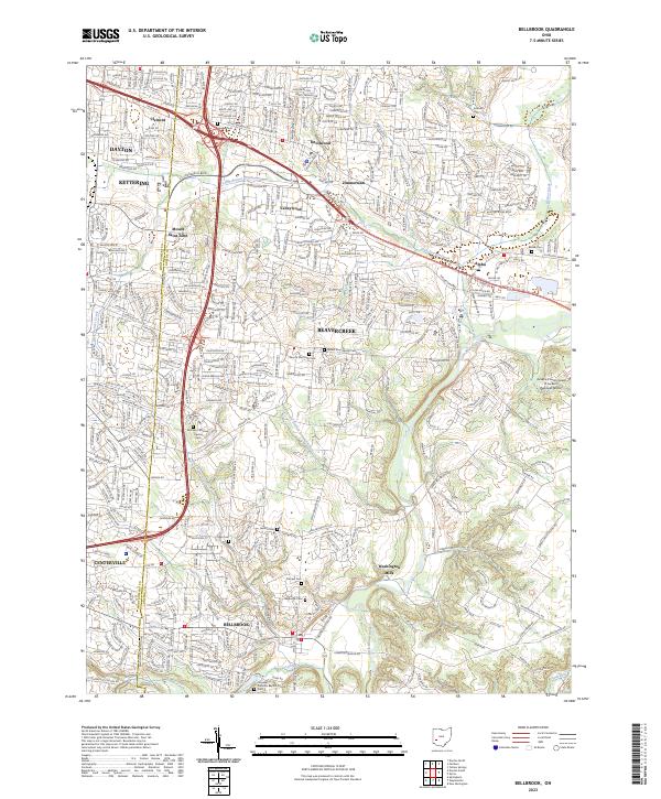
Loading map...2023 Map of Bellbrook
USGS Topo · Published 2023About this map
Bellbrook and Beavercreek anchor this transition between suburban development and the rolling Greene County landscape. This 2023 survey traces the modern layout of these expanding communities, following the winding course of the Little Miami River and the historical path of the Narrows Trce. Notable for genealogists, the map identifies numerous small family and community burial grounds, including the Pioneer Cem and the McLane/McLean Huston Cem.
Find a feature on this map
41 named features on this map. Tap any name to fly to it.
Don’t see what you’re looking for? This feature index may not catch every label — zoom into the map to look around manually.
Map Details
Date Portrayed2023
Date Published2023
PublisherU.S. Geological Survey
Map TypeTopographic
Scale1:24000
Physical Dimensions24 x 29 inches
Editions of this 2023 Bellbrook Map
This is the sole edition of this map. No revisions or reprints were ever made.
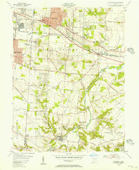
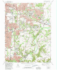
Historical Maps of Southeast Dayton Through Time
3 maps found
Featured Locations
Source Details
SourceU.S. Geological Survey
CopyrightPublic Domain