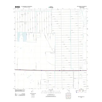
2012 Map of Belle Meade NE
USGS Topo · Published 2012About this map
Curry Island anchors the northwestern portion of this Collier County landscape, characterized by a transition from wetland terrain into a rigid, expansive grid of future development. The surveying reveals an ambitious network of numbered avenues stretching south from 10th Ave NW and 10th Ave NE, suggesting a period of significant suburban planning and land division. Major thoroughfares such as Golden Gate Blvd W and Golden Gate Blvd E bisect the area, providing the primary east-west structure for this emerging community.
Find a feature on this map
90 named features on this map. Tap any name to fly to it.
Don’t see what you’re looking for? This feature index may not catch every label — zoom into the map to look around manually.
Map Details
Editions of this 2012 Belle Meade NE Map
This is the sole edition of this map. No revisions or reprints were ever made.
Other maps of this area

1956 · West Palm Beach
USGS Topo · 1:250,000

1957 · West Palm Beach
USGS Topo · 1:250,000

1958 · West Palm Beach
USGS Topo · 1:250,000

1958 · Corkscrew SE
USGS Topo · 1:24,000

1958 · Belle Meade
USGS Topo · 1:24,000

1958 · Catherine Island
USGS Topo · 1:24,000

1958 · Belle Meade NE
USGS Topo · 1:24,000

1958 · Belle Meade NW
USGS Topo · 1:24,000

1958 · Immokalee SW
USGS Topo · 1:24,000

1958 · Corkscrew SW
USGS Topo · 1:24,000