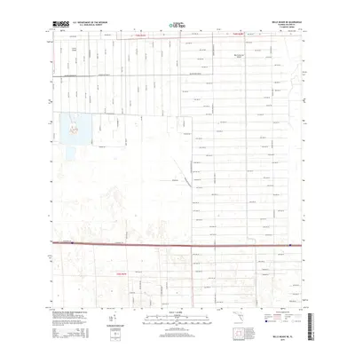
2015 Map of Belle Meade NE
USGS Topo · Published 2015About this map
Big Corkscrew Island and Curry Island rise as slightly higher elevations above the surrounding Collier County wetlands, serving as focal points in a landscape increasingly defined by a rigid grid of residential planning. This 2015 survey illustrates a transition toward rural-residential development, where vast numbers of numbered avenues—ranging from 10th Ave NW to 60th Ave SE—have been surveyed across the terrain. The presence of major arteries like Golden Gate Blvd E and Blackburn Rd indicates the expansion of the Golden Gate Estates area. While much of the land remains undeveloped cypress and pine flatwoods, the network of gravel and paved roads reveals the systematic preparation of the Florida interior for future habitation, even in areas historically isolated by the region's seasonal hydrology.
Find a feature on this map
97 named features on this map. Tap any name to fly to it.
Don’t see what you’re looking for? This feature index may not catch every label — zoom into the map to look around manually.
Map Details
Editions of this 2015 Belle Meade NE Map
This is the sole edition of this map. No revisions or reprints were ever made.
Other maps of this area

1956 · West Palm Beach
USGS Topo · 1:250,000

1957 · West Palm Beach
USGS Topo · 1:250,000

1958 · West Palm Beach
USGS Topo · 1:250,000

1958 · Corkscrew SE
USGS Topo · 1:24,000

1958 · Belle Meade
USGS Topo · 1:24,000

1958 · Catherine Island
USGS Topo · 1:24,000

1958 · Belle Meade NE
USGS Topo · 1:24,000

1958 · Belle Meade NW
USGS Topo · 1:24,000

1958 · Immokalee SW
USGS Topo · 1:24,000

1958 · Corkscrew SW
USGS Topo · 1:24,000