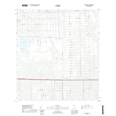
2018 Map of Belle Meade NE
USGS Topo · Published 2018About this map
Big Corkscrew Island and Curry Island stand as slightly elevated hammocks within a vast landscape of wetlands and drainage canals in this 2018 survey of Collier County. The map reveals the rigid grid system of the Golden Gate Estates development, where thoroughfares like Everglades Blvd N and Golden Gate Blvd E intersect a dense network of numbered avenues and streets. This geometric layout imposed on the swampy terrain of the Stumpy Strand illustrates mid-century Florida's large-scale land subdivision efforts. Beyond the residential grid, the map details the transition into more natural features, documenting the precise location of island hammocks that served as traditional landmarks before the modern road network was established.
Find a feature on this map
101 named features on this map. Tap any name to fly to it.
Don’t see what you’re looking for? This feature index may not catch every label — zoom into the map to look around manually.
Map Details
Editions of this 2018 Belle Meade NE Map
This is the sole edition of this map. No revisions or reprints were ever made.
Other maps of this area

1956 · West Palm Beach
USGS Topo · 1:250,000

1957 · West Palm Beach
USGS Topo · 1:250,000

1958 · West Palm Beach
USGS Topo · 1:250,000

1958 · Corkscrew SE
USGS Topo · 1:24,000

1958 · Belle Meade
USGS Topo · 1:24,000

1958 · Catherine Island
USGS Topo · 1:24,000

1958 · Belle Meade NE
USGS Topo · 1:24,000

1958 · Belle Meade NW
USGS Topo · 1:24,000

1958 · Immokalee SW
USGS Topo · 1:24,000

1958 · Corkscrew SW
USGS Topo · 1:24,000