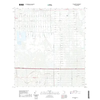
2021 Map of Belle Meade NE
USGS Topo · Published 2021About this map
Curry Island and Big Corkscrew Island rise as slightly higher ground within the low-lying wetlands of Collier County. This 2021 survey documents the geometric expansion of the Golden Gate area, characterized by an extensive grid of numbered streets and avenues such as 10th Ave NE and 22nd St NE. The landscape is defined by the tension between large-scale residential platting and the natural drainage patterns of the Florida Everglades, specifically near Stumpy Strand. The road network, including major thoroughfares like Golden Gate Blvd E and Everglades Blvd N, illustrates a massive effort to organize the subtropical terrain into a systematic residential layout. Unlike older organic settlements, the pattern here reflects modern land management and suburban subdivision on a significant scale.
Find a feature on this map
101 named features on this map. Tap any name to fly to it.
Don’t see what you’re looking for? This feature index may not catch every label — zoom into the map to look around manually.
Map Details
Editions of this 2021 Belle Meade NE Map
This is the sole edition of this map. No revisions or reprints were ever made.
Other maps of this area

1956 · West Palm Beach
USGS Topo · 1:250,000

1957 · West Palm Beach
USGS Topo · 1:250,000

1958 · West Palm Beach
USGS Topo · 1:250,000

1958 · Corkscrew SE
USGS Topo · 1:24,000

1958 · Belle Meade
USGS Topo · 1:24,000

1958 · Catherine Island
USGS Topo · 1:24,000

1958 · Belle Meade NE
USGS Topo · 1:24,000

1958 · Belle Meade NW
USGS Topo · 1:24,000

1958 · Immokalee SW
USGS Topo · 1:24,000

1958 · Corkscrew SW
USGS Topo · 1:24,000