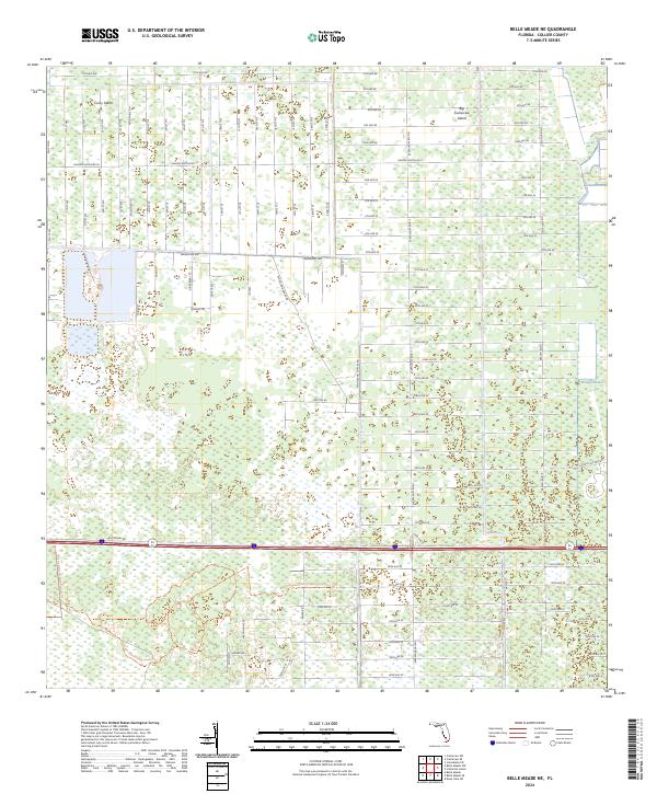
2024 Map of Belle Meade NE
USGS Topo · Published 2024About this map
Curry Island and Big Corkscrew Island rise as slightly elevated features within a landscape defined by subtropical wetlands and a rigid, large-scale residential grid. This map illustrates the intersection of mid-century drainage efforts and modern conservation, particularly within the Picayune Strand State Forest Trl. The area is characterized by a dense network of numbered avenues and streets, such as Golden Gate Blvd W and Wilson Blvd N, which overlay the natural hydrology of the Stumpy Strand. While many of these roads appear as surveyed lines through the swamp, the southern portion of the sheet highlights the state forest's role in reclaiming the natural flow of the western Everglades. Researchers will note the stark contrast between the planned development of Golden Gate and the preservation of the sawgrass and cypress strands.
Find a feature on this map
104 named features on this map. Tap any name to fly to it.
Don’t see what you’re looking for? This feature index may not catch every label — zoom into the map to look around manually.
Map Details
Editions of this 2024 Belle Meade NE Map
This is the sole edition of this map. No revisions or reprints were ever made.
Other maps of this area

1956 · West Palm Beach
USGS Topo · 1:250,000

1957 · West Palm Beach
USGS Topo · 1:250,000

1958 · West Palm Beach
USGS Topo · 1:250,000

1958 · Corkscrew SE
USGS Topo · 1:24,000

1958 · Belle Meade
USGS Topo · 1:24,000

1958 · Catherine Island
USGS Topo · 1:24,000

1958 · Belle Meade NE
USGS Topo · 1:24,000

1958 · Belle Meade NW
USGS Topo · 1:24,000

1958 · Immokalee SW
USGS Topo · 1:24,000

1958 · Corkscrew SW
USGS Topo · 1:24,000