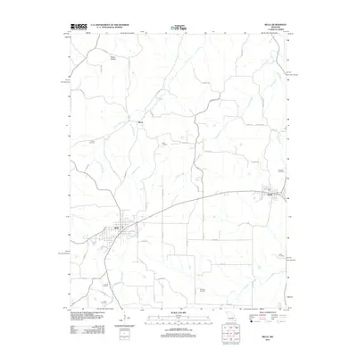
2012 Map of Belle
USGS Topo · Published 2012About this map
Bland and Belle anchor this landscape at the intersection of Gasconade and Maries counties, where a dense network of country roads connects scattered family homesteads and local landmarks. The settlement of Byron lies further north, situated near the headwaters of Little Third Creek and Bumpass Creek. This area is characterized by its numerous family and community burial grounds, including Old Bland Cemetery, Heyer Cemetery, and Liberty Cemetery, which offer significant value for genealogical research. The terrain is defined by a dendritic drainage system including Crider Creek and the Dry Fork, with Skillet Hollow marking the more varied elevations to the northwest. The layout of Belle shows a structured grid bisected by the diagonal route of 28, reflecting its development as a regional hub.
Find a feature on this map
58 named features on this map. Tap any name to fly to it.
Don’t see what you’re looking for? This feature index may not catch every label — zoom into the map to look around manually.
Map Details
Editions of this 2012 Belle Map
This is the sole edition of this map. No revisions or reprints were ever made.
Other maps of this area

1934 · Linn
USGS Topo · 1:48,000

1934 · Bland
USGS Topo · 1:62,500

1934 · Redbird
USGS Topo · 1:62,500

1937 · Bland
USGS Topo · 1:62,500

1937 · Vienna
USGS Topo · 1:62,500

1938 · Redbird
USGS Topo · 1:62,500

1938 · Vienna
USGS Topo · 1:48,000

1942 · Linn
USGS Topo · 1:62,500

1945 · Linn
USGS Topo · 1:62,500

1949 · Saint Louis
USGS Topo · 1:250,000