
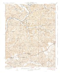
1937 Map of Bland
USGS Topo · Published 1937About this map
The Gasconade River winds through the northern portion of this Missouri landscape, framed by significant landmarks like Mt Sterling and Kings Lookout. The central terrain is defined by the drainages of Third Creek and Brushy Creek, where numerous small rural institutions served the agricultural community during the 1930s. Notable among these are the New Bethel Ch and a dense network of country schools, including Wildcat Sch and Success Sch.
Find a feature on this map
89 named features on this map. Tap any name to fly to it.
Don’t see what you’re looking for? This feature index may not catch every label — zoom into the map to look around manually.
Map Details
Editions of this 1937 Bland Map
2 editions found
Other maps of this area

1890 · Hermann
USGS Topo · 1:125,000

1890 · Fulton
USGS Topo · 1:125,000

1903 · Sullivan
USGS Topo · 1:125,000

1934 · Linn
USGS Topo · 1:48,000

1934 · Bland
USGS Topo · 1:62,500

1934 · Redbird
USGS Topo · 1:62,500

1935 · Gerald
USGS Topo · 1:48,000

1935 · Morrison
USGS Topo · 1:48,000

1936 · Hermann
USGS Topo · 1:48,000

1937 · Vienna
USGS Topo · 1:62,500