Loading...
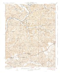
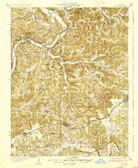
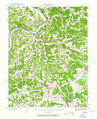
Loading map...1937 Map of Bland
USGS Topo · Published 1937About this map
The Gasconade River meanders through the heart of this central Missouri landscape, shaping a series of dramatic bluffs including Edwards Bluff and Heckman Bluff. In the mid-1930s, the region was characterized by small, dispersed rural settlements and a dense network of country schools, such as Miller Grove Sch and Wiggins Sch, which served as local anchors for the agricultural community. The Chicago Rock Island and Pacific railroad cuts across the lower half of the quadrangle, fueling the growth of Bland and Owensville as commercial hubs.
Find a feature on this map
101 named features on this map. Tap any name to fly to it.
Don’t see what you’re looking for? This feature index may not catch every label — zoom into the map to look around manually.
Map Details
Date Portrayed1937
Date Published1937
PublisherU.S. Geological Survey
Map TypeTopographic
Scale1:62,500
Physical Dimensions16.55 x 20.33 inches
Editions of this 1937 Bland Map
2 editions found
Historical Maps of Owensville Through Time
Featured Locations
Source Details
SourceU.S. Geological Survey
CopyrightPublic Domain