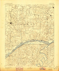
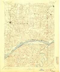
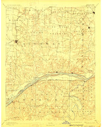
1890 Map of Fulton
USGS Topo · Published 1890About this map
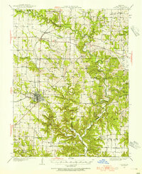
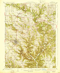
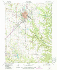
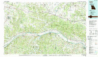
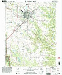
Fulton serves as the focal point of this late nineteenth-century Missouri landscape, situated where the rolling uplands of the Calwood Prairie meet a dense network of creek drainages. The map captures a critical period of transport development, with the Chicago and Alton Railroad running through the northwest and the Pacific Railroad hugging the southern bank of the Missouri River. Along the river, settlements like Portland, Chamois, and Bluffton are positioned near islands such as Aubert Island and Boat Creek Island, illustrating the river's historical role in commerce before modern flood control. This survey provides a precise look at the township divisions of the era, including Nine Mile and Loutre, while naming numerous family-linked watercourses like Byhams Creek and Harrison Branch that offer significant value for genealogical research in Callaway and Montgomery counties.
Find a feature on this map
116 named features on this map. Tap any name to fly to it.
Don’t see what you’re looking for? This feature index may not catch every label — zoom into the map to look around manually.
Map Details
Editions of this 1890 Fulton Map
5 editions found

Historical Maps of Fulton Through Time
9 maps found