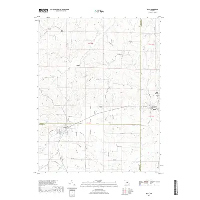
2017 Map of Belle
USGS Topo · Published 2017About this map
Belle and Bland anchor this 2017 survey where the borders of Osage, Gasconade, and Maries counties converge. The landscape is defined by the transition between the rolling uplands and the creek valleys that drain the region, including Crider Cr and Little Third Cr. The presence of Old Bland and the Old Bland Cem north of the modern town site highlights the shifting centers of community life in this part of Missouri.
Find a feature on this map
95 named features on this map. Tap any name to fly to it.
Don’t see what you’re looking for? This feature index may not catch every label — zoom into the map to look around manually.
Map Details
Editions of this 2017 Belle Map
This is the sole edition of this map. No revisions or reprints were ever made.
Other maps of this area

1934 · Linn
USGS Topo · 1:48,000

1934 · Bland
USGS Topo · 1:62,500

1934 · Redbird
USGS Topo · 1:62,500

1937 · Bland
USGS Topo · 1:62,500

1937 · Vienna
USGS Topo · 1:62,500

1938 · Redbird
USGS Topo · 1:62,500

1938 · Vienna
USGS Topo · 1:48,000

1942 · Linn
USGS Topo · 1:62,500

1945 · Linn
USGS Topo · 1:62,500

1949 · Saint Louis
USGS Topo · 1:250,000