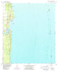
1956 Map of Bellefontaine
USGS Topo · Published 1986About this map
Mon Louis Island dominates the western shore of Mobile Bay in this mid-century topographic record of coastal Alabama. The landscape is defined by the winding course of the East Fowl River and a network of small settlements including Bellefontaine, Mon Louis, and Faustinas. Evidence of earlier transport infrastructure is visible in the Old Railroad Grade running parallel to Cedar Point Road, tracing a path toward the southern tip of the island. Offshore, the Mobile Ship Channel marks the vital maritime artery for the region, complete with numerous navigational lights. Local genealogy and land use are anchored by landmarks like Boudans Cem near the northern boundary and family-named locations such as Bayleys Corner and Smithport. The map illustrates a coastal community deeply integrated with its bayous and bayfront, showing the transition from the wooded interior to the marshy points like Fowl River Pt.
Find a feature on this map
23 named features on this map. Tap any name to fly to it.
Don’t see what you’re looking for? This feature index may not catch every label — zoom into the map to look around manually.
Map Details
Editions of this 1956 Bellefontaine Map
4 editions found
Other maps of this area

1921 · Point Clear
USGS Topo · 1:62,500

1921 · Fairhope
USGS Topo · 1:62,500

1921 · Delchamps
USGS Topo · 1:62,500

1922 · Mobile
USGS Topo · 1:62,500

1939 · Daphne
USGS Topo · 1:31,680

1940 · Hollingers Island
USGS Topo · 1:31,680

1940 · Mobile
USGS Topo · 1:62,500

1941 · Daphne
USGS Topo · 1:31,680

1941 · Cedar Point
USGS Topo · 1:62,500

1941 · Weeks Bay
USGS Topo · 1:62,500