2024 Map of Belleview
USGS Topo · Published 2024About this map
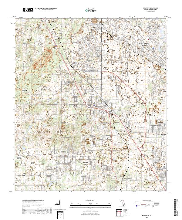
Belleview serves as the central hub of this Marion County landscape, where the dense residential grids of Belleview Heights and Silver Springs Shores meet the open corridors of the Cross Florida Greenway Trl. The map reveals a distinct pattern of land use, with aviation-focused communities like Leeward Air Ranch Airport and Back Achers Airport interspersed among the region's characteristic solution topography, including Blue Sink and Camellia Lake.
Find a feature on this map
70 named features on this map. Tap any name to fly to it.
Don’t see what you’re looking for? This feature index may not catch every label — zoom into the map to look around manually.
Map Details
Editions of this 2024 Belleview Map
This is the sole edition of this map. No revisions or reprints were ever made.
Other maps of this area

1893 · Panasoffkee
USGS Topo · 1:62,500

1895 · Panasoffkee
USGS Topo · 1:62,500

1895 · Ocala
USGS Topo · 1:62,500

1954 · Gainesville
USGS Topo · 1:250,000

1954 · Daytona Beach
USGS Topo · 1:250,000

1955 · Plant City
USGS Topo · 1:250,000

1955 · Orlando
USGS Topo · 1:250,000

1957 · Orlando
USGS Topo · 1:250,000

1958 · Orlando
USGS Topo · 1:250,000

1958 · Daytona Beach
USGS Topo · 1:250,000