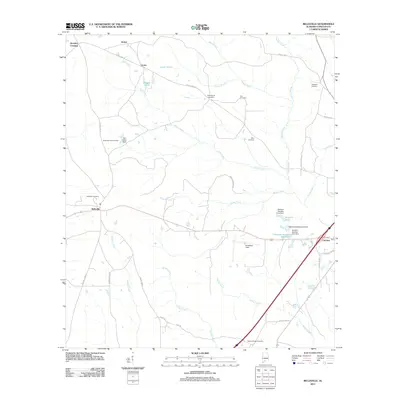
2011 Map of Belleville
USGS Topo · Published 2011About this map
Murder Creek and its many tributaries, including Otter Creek and Hunter Creek, define the drainage patterns of this rural Conecuh County landscape. The settlement of Belleville serves as a local hub, situated near the Belleville Lookout Tower and the Belleville Cemetery. A network of country roads like County Hwy-20 and County Hwy-15 connects smaller localities such as Stokes, Loree, and Brantley Crossing. The eastern portion of the map is characterized by a series of water management features including Stowers Pond and several numbered dams, specifically Stowers Number One Dam through Stowers Number Three Dam. For genealogists, the distribution of family and community burial sites like Arkadelphia Cemetery, Ivey Cemetery, and Robinson Cemetery provides specific points of interest for tracing local heritage.
Find a feature on this map
40 named features on this map. Tap any name to fly to it.
Don’t see what you’re looking for? This feature index may not catch every label — zoom into the map to look around manually.
Map Details
Editions of this 2011 Belleville Map
This is the sole edition of this map. No revisions or reprints were ever made.
Other maps of this area

1953 · Andalusia
USGS Topo · 1:250,000

1957 · Andalusia
USGS Topo · 1:250,000

1971 · Lyeffion
USGS Topo · 1:24,000

1971 · Range
USGS Topo · 1:24,000

1971 · Castleberry
USGS Topo · 1:24,000

1971 · Belleville
USGS Topo · 1:24,000

1971 · China
USGS Topo · 1:24,000

1971 · Burnt Corn
USGS Topo · 1:24,000

1971 · Repton
USGS Topo · 1:24,000

1982 · Evergreen
USGS Topo · 1:24,000