
1971 Map of China
USGS Topo · Published 1974About this map
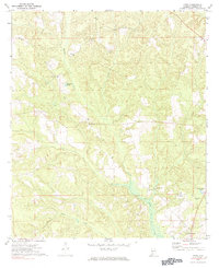
Murder Creek winds through the heart of this rural Conecuh Co. landscape, defining the topography of this corner of Alabama in the early 1970s. The settlement pattern is characterized by small, dispersed communities and a high concentration of country churches, including New Haven Ch and Centenary Ch, which often served as the social anchors for local residents.
Find a feature on this map
17 named features on this map. Tap any name to fly to it.
Don’t see what you’re looking for? This feature index may not catch every label — zoom into the map to look around manually.
Map Details
Editions of this 1971 China Map
2 editions found
Other maps of this area

1953 · Andalusia
USGS Topo · 1:250,000

1957 · Andalusia
USGS Topo · 1:250,000

1967 · Beatrice
USGS Topo · 1:24,000

1971 · Lyeffion
USGS Topo · 1:24,000

1971 · Belleville
USGS Topo · 1:24,000

1971 · Skinnerton
USGS Topo · 1:24,000

1971 · Burnt Corn
USGS Topo · 1:24,000

1971 · Repton
USGS Topo · 1:24,000

1971 · Bethel
USGS Topo · 1:24,000

1971 · Beatrice
USGS Topo · 1:24,000