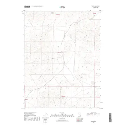
2018 Map of Belleville
USGS Topo · Published 2018About this map
Excelsior Mountains and the Candelaria Hills dominate this high-altitude landscape in Mineral County, Nevada. The terrain is characterized by steep contour gradients and intermittent water sources typical of the Great Basin, notably Belleville Spring located in the eastern portion of the quadrangle. Early 21st-century infrastructure is sparse, consisting primarily of primitive transit routes such as Moho Rd and Douglas Rd, which navigate the mountain passes. The map documents the vast, open character of the region, where topographical features like Little Summit serve as the primary landmarks. This survey provides a precise record of the public land survey system grid, showing the township and range divisions that have organized this territory since the 19th century.
Find a feature on this map
13 named features on this map. Tap any name to fly to it.
Don’t see what you’re looking for? This feature index may not catch every label — zoom into the map to look around manually.
Map Details
Editions of this 2018 Belleville Map
This is the sole edition of this map. No revisions or reprints were ever made.
Other maps of this area

1909 · Hawthorne
USGS Topo · 1:250,000

1911 · Hawthorne
USGS Topo · 1:250,000

1915 · Hawthorne
USGS Topo · 1:250,000

1948 · Walker Lake
USGS Topo · 1:250,000

1957 · Walker Lake
USGS Topo · 1:250,000

1962 · Walker Lake
USGS Topo · 1:250,000

1964 · Walker Lake
USGS Topo · 1:250,000
1967 · Columbus
USGS Topo · 1:24,000
1967 · Miller Mountain
USGS Topo · 1:24,000

1967 · Moho Mountain
USGS Topo · 1:24,000