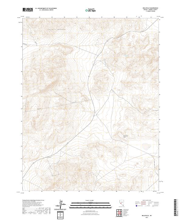
2021 Map of Belleville
USGS Topo · Published 2021About this map
The Excelsior Mountains and Candelaria Hills dominate this high-desert terrain in Nevada's Mineral County. This modern survey illustrates the rugged topography and essential access routes through the arid landscape, including Moho Rd and the winding path of Douglas Rd. The area is characterized by dramatic elevation shifts, marked by geological features like Little Summit in the southwestern portion of the quadrangle. The presence of Belleville Spring provides a rare point of named hydrography in an otherwise dry mountain environment. This map is particularly useful for researchers studying the physical geography of Nevada's basin and range province, showing how historical roads still navigate the complex contours between these two significant mountain systems.
Find a feature on this map
13 named features on this map. Tap any name to fly to it.
Don’t see what you’re looking for? This feature index may not catch every label — zoom into the map to look around manually.
Map Details
Editions of this 2021 Belleville Map
This is the sole edition of this map. No revisions or reprints were ever made.
Other maps of this area

1909 · Hawthorne
USGS Topo · 1:250,000

1911 · Hawthorne
USGS Topo · 1:250,000

1915 · Hawthorne
USGS Topo · 1:250,000

1948 · Walker Lake
USGS Topo · 1:250,000

1957 · Walker Lake
USGS Topo · 1:250,000

1962 · Walker Lake
USGS Topo · 1:250,000

1964 · Walker Lake
USGS Topo · 1:250,000
1967 · Columbus
USGS Topo · 1:24,000
1967 · Miller Mountain
USGS Topo · 1:24,000

1967 · Moho Mountain
USGS Topo · 1:24,000