
1971 Map of Bellview
USGS Topo · Published 1974About this map
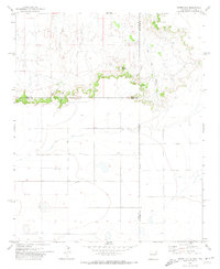
Bellview and the surrounding high plains of the Llano Estacado define this 1971 survey at the New Mexico and Texas border. The landscape is characterized by a sparse distribution of agricultural resources, anchored by the settlement of Hollene and a network of groundwater Wells that support the region's ranching and farming operations. The most significant geological feature is the drainage of Tierra Blanca Creek, which carves a distinct path through the terrain as it heads eastward toward the state line. Near the creek, evidence of local industry appears at a Gravel Pit, while the straight-line boundaries of Curry Co and Deaf Smith Co intersect with the New Mexico Texas border, marking the administrative edges of the Southern High Plains.
Find a feature on this map
7 named features on this map. Tap any name to fly to it.
Don’t see what you’re looking for? This feature index may not catch every label — zoom into the map to look around manually.
Map Details
Editions of this 1971 Bellview Map
This is the sole edition of this map. No revisions or reprints were ever made.
Other maps of this area

1954 · Clovis
USGS Topo · 1:250,000

1957 · Pleasant Hill
USGS Topo · 1:62,500

1958 · Clovis
USGS Topo · 1:250,000

1965 · Rhea
USGS Topo · 1:24,000

1971 · Mustang Lake
USGS Topo · 1:24,000

1971 · Garcia Lake
USGS Topo · 1:24,000

1971 · Day Canyon
USGS Topo · 1:24,000

1971 · Broadview
USGS Topo · 1:24,000
1971 · Endee Hill
USGS Topo · 1:24,000

1985 · Pleasant Hill NW
USGS Topo · 1:24,000