
1971 Map of Broadview
USGS Topo · Published 1974About this map
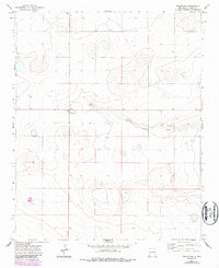
Broadview serves as the primary hub of this eastern New Mexico landscape, situated at the junction of high plains roadways during the early 1970s. The terrain is defined by the ephemeral path of Tierra Blanca Creek, which winds through the central portion of the quadrangle. This area of Curry County is characterized by a high-plains agricultural economy, where the distribution of Well locations and a specific Tank underscore the critical importance of water management for local ranching and farming. Evidence of localized industry is found in several Gravel Pit sites, suggesting the extraction of materials for road maintenance and regional infrastructure. The map's detail reflects a sparsely populated but active rural community, preserving the exact footprint of small-scale land use and water resources in the era before significant modern center-pivot irrigation transformations.
Find a feature on this map
5 named features on this map. Tap any name to fly to it.
Don’t see what you’re looking for? This feature index may not catch every label — zoom into the map to look around manually.
Map Details
Editions of this 1971 Broadview Map
2 editions found
Other maps of this area

1954 · Clovis
USGS Topo · 1:250,000

1957 · Pleasant Hill
USGS Topo · 1:62,500

1957 · Hammond Ranch
USGS Topo · 1:62,500

1958 · Clovis
USGS Topo · 1:250,000

1971 · Day Canyon
USGS Topo · 1:24,000

1971 · Wheatland
USGS Topo · 1:24,000

1971 · Grady
USGS Topo · 1:24,000

1971 · Bellview
USGS Topo · 1:24,000
1971 · Endee Hill
USGS Topo · 1:24,000

1985 · Pleasant Hill NW
USGS Topo · 1:24,000