
1971 Map of Wheatland
USGS Topo · Published 1974About this map
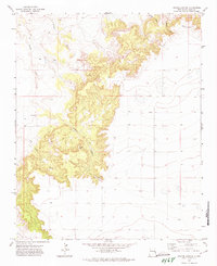
Wheatland serves as a central hub on this 1970s landscape, located where the high plains break into a dramatic series of canyon systems. This area marks the boundary between Quay Co and Curry Co, characterized by the transition from flat agricultural land to the intricate drainage networks of Tipton Canyon, Horseshoe Cave Canyon, and Deadman Canyon. The presence of the Wheatland Cem and various Gravel Pits reflects the long-standing local community and the utilization of the region's geological resources. To the north, the terrain drops toward Arroyo Saladito, while the southern reaches of the map show a grid of access roads and scattered water sources including several Wells. The placement of a Radio Tower on the high ground overlooking the canyons indicates the technological infrastructure integrated into this rural New Mexico setting during the early 1970s.
Find a feature on this map
15 named features on this map. Tap any name to fly to it.
Don’t see what you’re looking for? This feature index may not catch every label — zoom into the map to look around manually.
Map Details
Editions of this 1971 Wheatland Map
This is the sole edition of this map. No revisions or reprints were ever made.
Other maps of this area

1954 · Tucumcari
USGS Topo · 1:250,000

1954 · Clovis
USGS Topo · 1:250,000

1958 · Clovis
USGS Topo · 1:250,000

1958 · Tucumcari
USGS Topo · 1:250,000

1968 · Riley Camp
USGS Topo · 1:24,000

1968 · San Jon
USGS Topo · 1:24,000

1968 · Bedford Hill
USGS Topo · 1:24,000

1971 · Day Canyon
USGS Topo · 1:24,000
1971 · Apache Canyon
USGS Topo · 1:24,000

1971 · Broadview
USGS Topo · 1:24,000