
1968 Map of Riley Camp
USGS Topo · Published 1971About this map
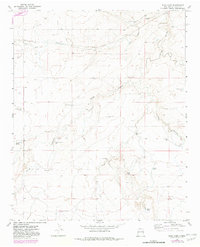
The high plains of Quay County come into focus in the late 1960s, revealing a landscape defined by ranching infrastructure and the Chicago Rock Island and Pacific railroad. The settlement of Bard and the namesake Riley Camp serve as primary points of human activity in this arid terrain, where water sources like Alamo Spring and Llano Spring dictated the placement of homesteads and cattle operations. A significant network of family-named landmarks, such as Charley White Windmill and Durham Windmill, illustrates how the land was managed and partitioned. The presence of Bard Cem and Boot Hill Cem provides essential touchpoints for genealogists tracing the early residents of this border region. This survey captures a specific moment when the rural economy relied heavily on wind-powered wells and the strategic drainage of the San Jon Creek and Arroyo Trujillo systems.
Find a feature on this map
31 named features on this map. Tap any name to fly to it.
Don’t see what you’re looking for? This feature index may not catch every label — zoom into the map to look around manually.
Map Details
Editions of this 1968 Riley Camp Map
2 editions found
Other maps of this area

1954 · Tucumcari
USGS Topo · 1:250,000

1954 · Clovis
USGS Topo · 1:250,000

1958 · Clovis
USGS Topo · 1:250,000

1958 · Tucumcari
USGS Topo · 1:250,000

1968 · Porter
USGS Topo · 1:24,000

1968 · Rock Camp
USGS Topo · 1:24,000

1968 · San Jon
USGS Topo · 1:24,000

1968 · Bard
USGS Topo · 1:24,000

1968 · Glenrio
USGS Topo · 1:24,000

1971 · Day Canyon
USGS Topo · 1:24,000