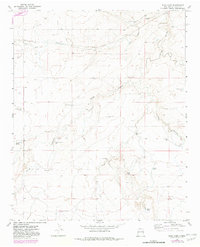
1968 Map of Riley Camp
USGS Topo · Published 1982About this map
San Jon Creek and the meandering Arroyo Saladito carve through this high plains landscape of eastern Quay County, defined by a network of ranching infrastructure and seasonal water sources. The map reveals the critical importance of water management in this arid environment, evidenced by numerous family-named landmarks and technological features like the Durham Windmill, Walker Well, and Allen Tank. These water points supported remote outposts such as Riley Camp and the Davidson Ranch.
Find a feature on this map
29 named features on this map. Tap any name to fly to it.
Don’t see what you’re looking for? This feature index may not catch every label — zoom into the map to look around manually.
Map Details
Editions of this 1968 Riley Camp Map
2 editions found
Other maps of this area

1954 · Tucumcari
USGS Topo · 1:250,000

1954 · Clovis
USGS Topo · 1:250,000

1958 · Clovis
USGS Topo · 1:250,000

1958 · Tucumcari
USGS Topo · 1:250,000

1968 · Porter
USGS Topo · 1:24,000

1968 · Rock Camp
USGS Topo · 1:24,000

1968 · Riley Camp
USGS Topo · 1:24,000

1968 · San Jon
USGS Topo · 1:24,000

1968 · Bard
USGS Topo · 1:24,000

1968 · Glenrio
USGS Topo · 1:24,000