
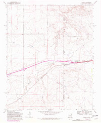
1968 Map of Glenrio
USGS Topo · Published 1971About this map
The Chicago Rock Island and Pacific railway and U.S. Route 66 dictate the pulse of this borderland landscape where New Mexico meets Texas. The small community of Glenrio sits directly on the state line, serving as a distinct waypoint for travelers and rail transport during the late 1960s. South of the main thoroughfare, the older settlement of Endee is marked by the Endee Cem, offering a focal point for genealogical research in Quay County. The terrain is defined by the erosion patterns of Trujillo Creek and Martha Creek, which carve through the plains toward Sand Point Draw. This survey captures the area just as the interstate era was shifting traffic away from traditional roadside stops like the Roadside Park near the boundary of Oldham and Deaf Smith counties.
Find a feature on this map
18 named features on this map. Tap any name to fly to it.
Don’t see what you’re looking for? This feature index may not catch every label — zoom into the map to look around manually.
Map Details
Editions of this 1968 Glenrio Map
2 editions found
Other maps of this area

1954 · Tucumcari
USGS Topo · 1:250,000

1958 · Tucumcari
USGS Topo · 1:250,000

1966 · Moser Ranch
USGS Topo · 1:24,000

1966 · Signal Spring
USGS Topo · 1:24,000

1966 · Sand Point
USGS Topo · 1:24,000

1968 · Rock Camp
USGS Topo · 1:24,000

1968 · Blue Hole
USGS Topo · 1:24,000

1968 · Riley Camp
USGS Topo · 1:24,000

1968 · Bard
USGS Topo · 1:24,000
1968 · Martin Draw
USGS Topo · 1:24,000