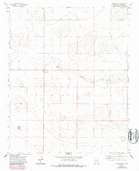
1971 Map of Broadview
USGS Topo · Published 1987About this map
Broadview serves as the central hub of this eastern New Mexico landscape, situated amidst the high plains of Curry County. The topography is defined by the ephemeral drainage of Tierra Blanca Creek, which winds eastward through the terrain. This 1971 survey, updated with 1983 aerial data, illustrates a region dominated by agricultural ranching and large-scale land management, evidenced by the numerous wells and a prominent Tank located in the southern sections. Local industry and road maintenance are marked by a Gravel Pit along the creek, providing a clear view of the rural infrastructure at the time. The map's grid-like road system and scattered water sources highlight the specialized adaptations required for settlement and commerce in this semi-arid environment during the late twentieth century.
Find a feature on this map
4 named features on this map. Tap any name to fly to it.
Don’t see what you’re looking for? This feature index may not catch every label — zoom into the map to look around manually.
Map Details
Editions of this 1971 Broadview Map
2 editions found
Other maps of this area

1954 · Clovis
USGS Topo · 1:250,000

1957 · Pleasant Hill
USGS Topo · 1:62,500

1957 · Hammond Ranch
USGS Topo · 1:62,500

1958 · Clovis
USGS Topo · 1:250,000

1971 · Day Canyon
USGS Topo · 1:24,000

1971 · Wheatland
USGS Topo · 1:24,000

1971 · Broadview
USGS Topo · 1:24,000

1971 · Grady
USGS Topo · 1:24,000

1971 · Bellview
USGS Topo · 1:24,000
1971 · Endee Hill
USGS Topo · 1:24,000