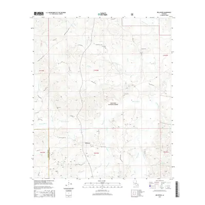
2015 Map of Bellwood
USGS Topo · Published 2015About this map
Kisatchie National Forest dominates this section of Natchitoches Parish, where the winding course of Kisatchie Bayou and its numerous tributaries create a complex network of wetlands and drainages. The small settlement of Bellwood serves as a central point for a landscape defined by timberlands and rural homesteads. This 2015 survey reveals a pattern of scattered family and community sites, including Friendship Cemetery, Jackson Cem, and Moss Cem, which are often located near local thoroughfares such as Bellwood Church Rd. The terrain is deeply etched by water, with Bayou Santabarb and Bayou de Muse cutting through the forest, reflecting the natural hydrography of central Louisiana before extensive modern development. This map provides a clear record of the intersection between public forest lands and private parish holdings along the border with Sabine Parish.
Find a feature on this map
57 named features on this map. Tap any name to fly to it.
Don’t see what you’re looking for? This feature index may not catch every label — zoom into the map to look around manually.
Map Details
Editions of this 2015 Bellwood Map
This is the sole edition of this map. No revisions or reprints were ever made.
Other maps of this area

1935 · Hagewood
USGS Topo · 1:31,680

1937 · Bermuda
USGS Topo · 1:31,680

1937 · Bellwood
USGS Topo · 1:31,680

1937 · Cypress
USGS Topo · 1:31,680

1942 · Many
USGS Topo · 1:62,500

1942 · Florien
USGS Topo · 1:62,500

1942 · Kisatchie
USGS Topo · 1:62,500

1943 · Many
USGS Topo · 1:62,500

1943 · Kisatchie
USGS Topo · 1:62,500

1943 · Provencal
USGS Topo · 1:62,500