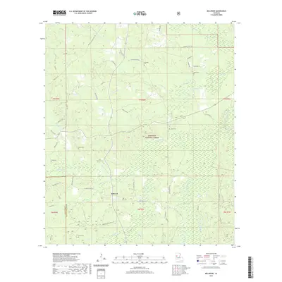
2020 Map of Bellwood
USGS Topo · Published 2020About this map
Bellwood serves as the central hub of this Natchitoches Parish landscape, situated at a junction of local roads and surrounded by the expansive woodlands of the Kisatchie National Forest. The map reveals a deeply etched drainage system defined by the Kisatchie Bayou and numerous smaller tributaries like Horsepen Cr and McKims Cr. This network of creeks and bayous is interspersed with significant wetland features such as Cunningham Brake and Provencal Lake, reflecting the low-lying, water-dependent geography of the region.
Find a feature on this map
66 named features on this map. Tap any name to fly to it.
Don’t see what you’re looking for? This feature index may not catch every label — zoom into the map to look around manually.
Map Details
Editions of this 2020 Bellwood Map
This is the sole edition of this map. No revisions or reprints were ever made.
Other maps of this area

1935 · Hagewood
USGS Topo · 1:31,680

1937 · Bermuda
USGS Topo · 1:31,680

1937 · Bellwood
USGS Topo · 1:31,680

1937 · Cypress
USGS Topo · 1:31,680

1942 · Many
USGS Topo · 1:62,500

1942 · Florien
USGS Topo · 1:62,500

1942 · Kisatchie
USGS Topo · 1:62,500

1943 · Many
USGS Topo · 1:62,500

1943 · Kisatchie
USGS Topo · 1:62,500

1943 · Provencal
USGS Topo · 1:62,500