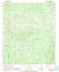
1983 Map of Bellwood
USGS Topo · Published 1991About this map
Kisatchie National Forest dominates this landscape in western Natchitoches Parish, where the small community of Bellwood is positioned along the boundary with the Red Dirt National Wildlife Management Area. The terrain is defined by a dense network of drainage systems, including the meandering Bayou Santabarb and Bayou de Muse, which flow through the timberlands.
Find a feature on this map
36 named features on this map. Tap any name to fly to it.
Don’t see what you’re looking for? This feature index may not catch every label — zoom into the map to look around manually.
Map Details
Editions of this 1983 Bellwood Map
This is the sole edition of this map. No revisions or reprints were ever made.
Other maps of this area

1935 · Hagewood
USGS Topo · 1:31,680

1937 · Bermuda
USGS Topo · 1:31,680

1937 · Bellwood
USGS Topo · 1:31,680

1937 · Cypress
USGS Topo · 1:31,680

1942 · Many
USGS Topo · 1:62,500

1942 · Florien
USGS Topo · 1:62,500

1942 · Kisatchie
USGS Topo · 1:62,500

1943 · Many
USGS Topo · 1:62,500

1943 · Kisatchie
USGS Topo · 1:62,500

1943 · Provencal
USGS Topo · 1:62,500