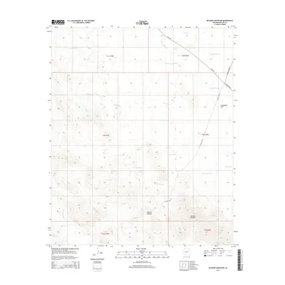
2014 Map of Belmont Mountain
USGS Topo · Published 2014About this map
Belmont Mountain rises as the central topographic feature of this arid landscape in Maricopa County, positioned within a complex network of ephemeral desert drainages. The area is defined by the convergence of several major washes, including Woodchopper Wash, Jackrabbit Wash, and the uniquely named Beer Bottle Wash, which together carve through the surrounding terrain. Toward the northeast, the land flattens into the Hassayampa Plain, illustrating the transition from the rugged peaks of the Belmont Mountains to the open desert floor.
Find a feature on this map
22 named features on this map. Tap any name to fly to it.
Don’t see what you’re looking for? This feature index may not catch every label — zoom into the map to look around manually.
Map Details
Editions of this 2014 Belmont Mountain Map
This is the sole edition of this map. No revisions or reprints were ever made.
Other maps of this area

1942 · Vicksburg
USGS Topo · 1:250,000

1954 · Phoenix
USGS Topo · 1:250,000

1957 · Phoenix
USGS Topo · 1:250,000

1958 · Phoenix
USGS Topo · 1:250,000

1960 · Phoenix
USGS Topo · 1:250,000

1961 · Vulture Mountains
USGS Topo · 1:62,500

1961 · Big Horn Mts
USGS Topo · 1:62,500

1962 · Belmont Mts
USGS Topo · 1:62,500
1962 · Aguila
USGS Topo · 1:62,500

1969 · Phoenix
USGS Topo · 1:250,000