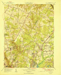
1951 Map of Beltsville
USGS Topo · Published 1951About this map
The National Agricultural Research Center and the sprawling Naval Ordnance Laboratory dominate this landscape during a period of transition between the postwar suburbs and the rural dairy and tobacco roots of the region. This 1951 record shows a dense network of early schools and institutions, including the Ammendale Normal Institute, Briarley Military Academy, and Xaverian College, indicating the area's importance as an educational and research corridor between Washington and Baltimore.
Find a feature on this map
92 named features on this map. Tap any name to fly to it.
Don’t see what you’re looking for? This feature index may not catch every label — zoom into the map to look around manually.
Map Details
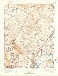
Editions of this 1951 Beltsville Map
2 editions found
Other maps of this area

1890 · Mt. Vernon
USGS Topo · 1:125,000

1891 · Mt. Vernon
USGS Topo · 1:125,000

1892 · Laurel
USGS Topo · 1:62,500

1893 · Frederick
USGS Topo · 1:125,000

1894 · Laurel
USGS Topo · 1:62,500

1894 · Frederick
USGS Topo · 1:125,000

1894 · Mt. Vernon
USGS Topo · 1:125,000

1897 · Laurel
USGS Topo · 1:62,500

1897 · Mt. Vernon
USGS Topo · 1:125,000

1899 · Patuxent
USGS Topo · 1:125,000