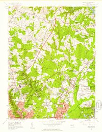
1956 Map of Beltsville
USGS Topo · Published 1958About this map
College Park and the surrounding Maryland suburbs are shown here during a period of significant mid-century expansion along the Baltimore Ohio Railroad. This landscape is heavily defined by large institutional holdings, most notably the massive U S Department of Agriculture Research Center and the U S Naval Reservation Ordnance Laboratory. These government tracts create a distinct spatial pattern, preserved as open or specialized space amid rapidly growing residential developments like Adelphi Village, Oakview, and Indian Spring Village.
Find a feature on this map
117 named features on this map. Tap any name to fly to it.
Don’t see what you’re looking for? This feature index may not catch every label — zoom into the map to look around manually.
Map Details
Editions of this 1956 Beltsville Map
This is the sole edition of this map. No revisions or reprints were ever made.
Other maps of this area

1890 · Mt. Vernon
USGS Topo · 1:125,000

1891 · Mt. Vernon
USGS Topo · 1:125,000

1892 · Laurel
USGS Topo · 1:62,500

1893 · Frederick
USGS Topo · 1:125,000

1894 · Laurel
USGS Topo · 1:62,500

1894 · Frederick
USGS Topo · 1:125,000

1894 · Mt. Vernon
USGS Topo · 1:125,000

1897 · Laurel
USGS Topo · 1:62,500

1897 · Mt. Vernon
USGS Topo · 1:125,000

1899 · Patuxent
USGS Topo · 1:125,000