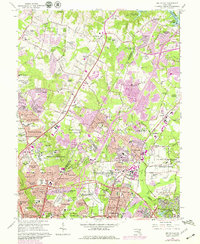
1964 Map of Beltsville
USGS Topo · Published 1979About this map
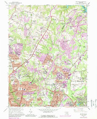
Large federal research and military installations dominate the landscape between Beltsville and White Oak, highlighting the expansion of government infrastructure in the post-war era. The sprawling US Dept of Agriculture Research Center and the US Naval Ordnance Laboratory occupy significant tracts of land, surrounded by rapidly developing residential subdivisions like Hollywood Park and Fairview Estates. This period of growth is further evidenced by the extensive network of newly charted schools, including High Point High Sch and Regina High Sch, which serve the burgeoning suburban population near the Capital Beltway.
Find a feature on this map
167 named features on this map. Tap any name to fly to it.
Don’t see what you’re looking for? This feature index may not catch every label — zoom into the map to look around manually.
Map Details
Editions of this 1964 Beltsville Map
5 editions found
Other maps of this area

1890 · Mt. Vernon
USGS Topo · 1:125,000

1891 · Mt. Vernon
USGS Topo · 1:125,000

1892 · Laurel
USGS Topo · 1:62,500

1893 · Frederick
USGS Topo · 1:125,000

1894 · Laurel
USGS Topo · 1:62,500

1894 · Frederick
USGS Topo · 1:125,000

1894 · Mt. Vernon
USGS Topo · 1:125,000

1897 · Laurel
USGS Topo · 1:62,500

1897 · Mt. Vernon
USGS Topo · 1:125,000

1899 · Patuxent
USGS Topo · 1:125,000