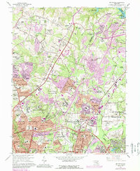
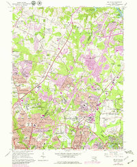
1964 Map of Beltsville
USGS Topo · Published 1989About this map
The US Naval Ordnance Laboratory dominates the central landscape of this Maryland corridor, reflecting the significant federal and scientific presence that shaped the region during the mid-20th century. Suburban expansion is evident in the cluster of residential developments such as Hillandale Heights, Springbrook Manor, and Sniders Estates, which contrast with the academic and agricultural tracts of the University of Maryland Plant Research Farm and the US Dept of Agriculture Agricultural Research Center. This era shows a transition where traditional institutions like the Ammendale Normal Institute and Carver Memorial Cemetery coexist with burgeoning infrastructure like the Capital Beltway and the Baltimore Washington Parkway. Local life is anchored by numerous schools and churches, from St Marks Ch to High Point High Sch, while the Baltimore & Ohio railroad line traces the industrial spine of the eastern sector near Beltsville.
Find a feature on this map
161 named features on this map. Tap any name to fly to it.
Don’t see what you’re looking for? This feature index may not catch every label — zoom into the map to look around manually.
Map Details
Editions of this 1964 Beltsville Map
5 editions found
Other maps of this area

1890 · Mt. Vernon
USGS Topo · 1:125,000

1891 · Mt. Vernon
USGS Topo · 1:125,000

1892 · Laurel
USGS Topo · 1:62,500

1893 · Frederick
USGS Topo · 1:125,000

1894 · Laurel
USGS Topo · 1:62,500

1894 · Frederick
USGS Topo · 1:125,000

1894 · Mt. Vernon
USGS Topo · 1:125,000

1897 · Laurel
USGS Topo · 1:62,500

1897 · Mt. Vernon
USGS Topo · 1:125,000

1899 · Patuxent
USGS Topo · 1:125,000