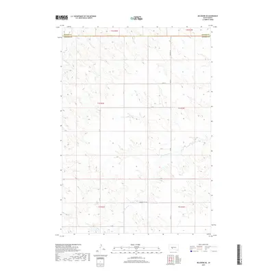
2017 Map of Belvidere NE
USGS Topo · Published 2017About this map
W Fork Brave Bull Cr and Indian Cr define the drainage patterns across this section of the South Dakota plains, where the landscape is marked by the transition between Haakon and Jackson counties. The terrain is structured by a grid of rural sections, with local travel largely facilitated by north-south routes like Belvidere Rd and Co Rd 3. These roads, along with east-west connectors such as 235th St and Community Well Rd, reflect the organized land management typical of the region's agricultural and ranching history. While the map is sparse of concentrated settlements, the inclusion of features like Community Well Rd points to the vital importance of water infrastructure in this expansive environment during the late twenty-first century.
Find a feature on this map
19 named features on this map. Tap any name to fly to it.
Don’t see what you’re looking for? This feature index may not catch every label — zoom into the map to look around manually.
Map Details
Editions of this 2017 Belvidere NE Map
This is the sole edition of this map. No revisions or reprints were ever made.
Other maps of this area

1951 · Stamford SW
USGS Topo · 1:24,000

1951 · Belvidere
USGS Topo · 1:24,000

1951 · Belvidere SW
USGS Topo · 1:24,000

1953 · Belvidere NE
USGS Topo · 1:24,000

1954 · Belvidere NW
USGS Topo · 1:24,000

1954 · Powell
USGS Topo · 1:24,000

1954 · Midland
USGS Topo · 1:24,000

1954 · Nowlin
USGS Topo · 1:24,000

1954 · Pierre
USGS Topo · 1:250,000

1955 · Martin
USGS Topo · 1:250,000