
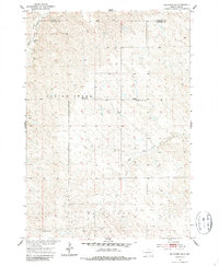
1953 Map of Belvidere NE
USGS Topo · Published 1955About this map
Indian Creek and Bull Creek meander through the high plains of the Belvidere region, defining a landscape shaped by the drainage patterns of the Missouri River Basin. This mid-century survey, produced during a period of federal interest in the basin's development, reveals a sparse network of rural educational outposts that served the ranching families of Jackson and Haakon counties. The presence of the Harris Sch (Abandoned) suggests early twentieth-century shifts in local population, while the Highland Center Sch and North Rural Sch remained active centers for the community. The remote character of the area is further evidenced by isolated water management features like Winne Dam, which supported the livestock industry in this arid stretch of South Dakota. The detailed topography highlights the intricate breaks and ridges leading toward the West Fork drainage, documenting a specific era of land use before modern agricultural shifts.
Find a feature on this map
10 named features on this map. Tap any name to fly to it.
Don’t see what you’re looking for? This feature index may not catch every label — zoom into the map to look around manually.
Map Details
Editions of this 1953 Belvidere NE Map
2 editions found
Other maps of this area

1951 · Stamford SW
USGS Topo · 1:24,000

1951 · Belvidere
USGS Topo · 1:24,000

1951 · Belvidere SW
USGS Topo · 1:24,000

1954 · Belvidere NW
USGS Topo · 1:24,000

1954 · Powell
USGS Topo · 1:24,000

1954 · Midland
USGS Topo · 1:24,000

1954 · Nowlin
USGS Topo · 1:24,000

1954 · Pierre
USGS Topo · 1:250,000

1955 · Martin
USGS Topo · 1:250,000

1958 · Pierre
USGS Topo · 1:250,000