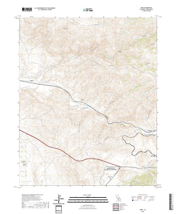
2022 Map of Bena
USGS Topo · Published 2022About this map
Caliente and Bealville anchor this survey of the transitional landscape where the San Joaquin Valley meets the rising foothills. The terrain is defined by a dense network of drainages and seasonal water sources, including Walker Basin Cr and Caliente Cr, along with numerous springs such as Rattlesnake Spring and Railroad Spring. A distinct series of high-elevation flats, including Reader Flat, Chino Flat, and Tollhouse Flat, suggest the historical movement of livestock and travelers through the canyon passes. The southern portion of the map is dominated by the Bakersfield National Cem, situated near E Bear Mountain Blvd. This topography highlights the complex geography between the valley floor and the higher peaks like Pampa Peak, tracing the winding paths of Bena Rd and Caliente Bodfish Rd as they navigate Scraper Canyon and Telephone Canyon.
Find a feature on this map
52 named features on this map. Tap any name to fly to it.
Don’t see what you’re looking for? This feature index may not catch every label — zoom into the map to look around manually.
Map Details
Editions of this 2022 Bena Map
This is the sole edition of this map. No revisions or reprints were ever made.
Other maps of this area

1914 · Caliente
USGS Topo · 1:125,000

1929 · Bena
USGS Topo · 1:31,680

1930 · Bear Mountain
USGS Topo · 1:31,680

1930 · Arvin
USGS Topo · 1:31,680

1931 · Edison
USGS Topo · 1:31,680

1932 · Bena
USGS Topo · 1:31,680

1933 · Arvin
USGS Topo · 1:31,680

1933 · Bear Mountain
USGS Topo · 1:31,680

1943 · Cummings Mountain
USGS Topo · 1:62,500

1943 · Breckenridge Mountain
USGS Topo · 1:62,500