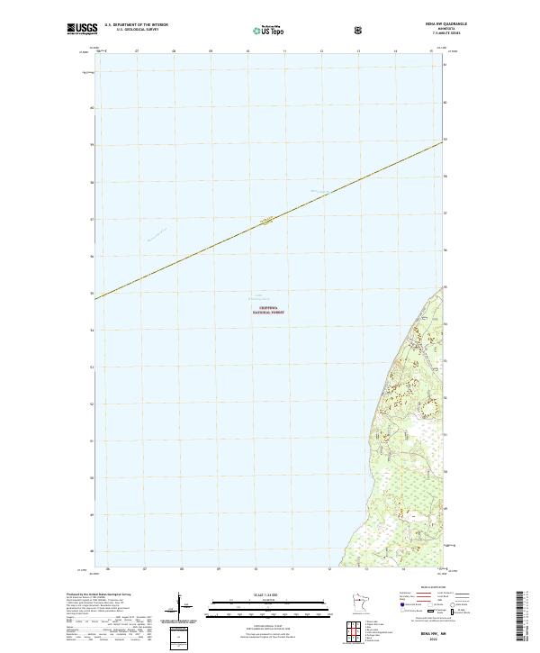
2022 Map of Bena NW
USGS Topo · Published 2022About this map
The Mississippi River winds through the northern reaches of the Chippewa National Forest, defining the aquatic landscape of this portion of northern Minnesota. This particular stretch of the river serves as a boundary between Itasca and Cass counties, where the waterway feeds into the expansive waters of Lake Winnibigoshish. The map illustrates a primarily forested and wetland environment, largely dominated by the open water of the lake in the western and central sections.
Find a feature on this map
13 named features on this map. Tap any name to fly to it.
Don’t see what you’re looking for? This feature index may not catch every label — zoom into the map to look around manually.
Map Details
Editions of this 2022 Bena NW Map
This is the sole edition of this map. No revisions or reprints were ever made.
Other maps of this area

1919 · Rosy
USGS Topo · 1:62,500

1919 · Max
USGS Topo · 1:62,500

1954 · Bemidji
USGS Topo · 1:250,000

1957 · Bemidji
USGS Topo · 1:250,000

1958 · Bemidji
USGS Topo · 1:250,000

1971 · Dixon Lake
USGS Topo · 1:24,000

1971 · Nushka Lake
USGS Topo · 1:24,000

1971 · Raven Lake
USGS Topo · 1:24,000

1971 · Bena
USGS Topo · 1:24,000
1971 · Max
USGS Topo · 1:24,000