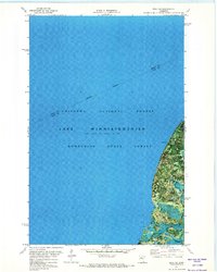
1971 Map of Bena NW
USGS Topo · Published 1974About this map
Lake Winnibigoshish dominates this orthophotomap, which utilizes high-altitude aerial imagery from 1969 to illustrate the vast aquatic landscape of north-central Minnesota. The reservoir is captured at a normal pool elevation of 1299 feet, reflecting the regulated nature of this massive water body within the Chippewa National Forest and Bowstring State Forest. The map provides a hybrid view, combining traditional topographic contour lines with a direct photographic record of the shoreline and surrounding timberland. The Itasca Co Cass Co line bisects the water along an Indefinite Boundary, highlighting the difficulty of precise surveying across such extensive wetlands and open water. A single Boat Ramp on the eastern shore marks one of the few improved access points in this largely protected wilderness area.
Find a feature on this map
6 named features on this map. Tap any name to fly to it.
Don’t see what you’re looking for? This feature index may not catch every label — zoom into the map to look around manually.
Map Details
Editions of this 1971 Bena NW Map
This is the sole edition of this map. No revisions or reprints were ever made.
Other maps of this area

1919 · Rosy
USGS Topo · 1:62,500

1919 · Max
USGS Topo · 1:62,500

1954 · Bemidji
USGS Topo · 1:250,000

1957 · Bemidji
USGS Topo · 1:250,000

1958 · Bemidji
USGS Topo · 1:250,000

1971 · Dixon Lake
USGS Topo · 1:24,000

1971 · Nushka Lake
USGS Topo · 1:24,000

1971 · Raven Lake
USGS Topo · 1:24,000

1971 · Bena
USGS Topo · 1:24,000
1971 · Max
USGS Topo · 1:24,000