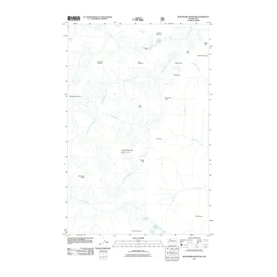
2011 Map of Benchmark Mountain
USGS Topo · Published 2011About this map
Benchmark Mountain Lookout stands as a central point of reference in this high-altitude landscape where the headwaters of several major river systems originate. The terrain is defined by a complex network of ridges and basins, including Vimy Ridge and West Cady Ridge, which separate the drainages of the North Fork Skykomish River, the North Fork Sauk River, and the Little Wenatchee River. This 2011 survey documents the established backcountry infrastructure of the era, such as the Blue Lake Shelter near the shores of Blue Lake. Strategic mountain crossings like Cady Pass, Sauk Pass, and Wards Pass suggest a long history of travel through these heights. To the south, high-elevation water bodies like Fortune Ponds, Pear Lake, and Peach Lake sit tucked below Fortune Mountain, illustrating the glacial-carved character of the region.
Find a feature on this map
34 named features on this map. Tap any name to fly to it.
Don’t see what you’re looking for? This feature index may not catch every label — zoom into the map to look around manually.
Map Details
Editions of this 2011 Benchmark Mountain Map
This is the sole edition of this map. No revisions or reprints were ever made.
Other maps of this area

1899 · Glacier Peak
USGS Topo · 1:125,000

1901 · Glacier Peak
USGS Topo · 1:125,000

1902 · Skykomish
USGS Topo · 1:125,000

1905 · Skykomish
USGS Topo · 1:125,000

1950 · Glacier Peak
USGS Topo · 1:62,500

1955 · Concrete
USGS Topo · 1:250,000

1957 · Wenatchee
USGS Topo · 1:250,000

1958 · Concrete
USGS Topo · 1:250,000

1962 · Concrete
USGS Topo · 1:250,000

1965 · Captain Point
USGS Topo · 1:24,000