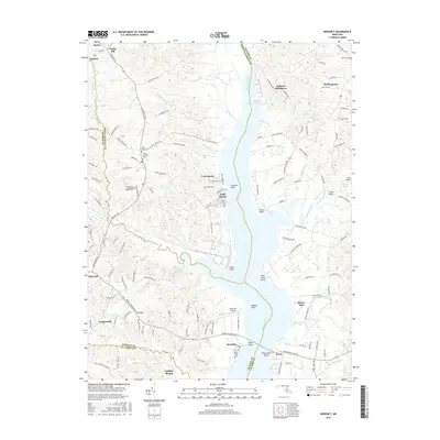
2016 Map of Benedict
USGS Topo · Published 2016About this map
The Patuxent River bisects this Maryland landscape, serving as a natural boundary for four counties including Prince George's and Calvert. Along its western banks, the small incorporated town of Eagle Harbor and the settlement of Cedarhaven occupy a prominent bend in the river. This mid-2010s survey reveals a dense network of local roads and family-named routes such as Doctor Bowen Rd and Eastview Farm Rd, indicating a transition from traditional agricultural land use to residential pockets.
Find a feature on this map
146 named features on this map. Tap any name to fly to it.
Don’t see what you’re looking for? This feature index may not catch every label — zoom into the map to look around manually.
Map Details
Editions of this 2016 Benedict Map
This is the sole edition of this map. No revisions or reprints were ever made.
Other maps of this area

1892 · Leonardtown
USGS Topo · 1:62,500

1892 · Prince Frederick
USGS Topo · 1:62,500

1892 · Brandywine
USGS Topo · 1:62,500

1894 · Wicomico
USGS Topo · 1:62,500

1895 · Prince Frederick
USGS Topo · 1:62,500

1895 · Wicomico
USGS Topo · 1:62,500

1895 · Brandywine
USGS Topo · 1:62,500

1895 · Leonardtown
USGS Topo · 1:62,500

1895 · Nomini
USGS Topo · 1:125,000

1898 · Nomini
USGS Topo · 1:125,000