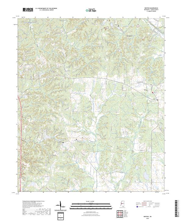
2024 Map of Benton
USGS Topo · Published 2024About this map
Benton and the surrounding Yazoo County countryside are defined by a network of creeks and rural routes that have long shaped the local landscape. The terrain is notably carved by Walesheba Creek and Little Walesheba Creek, which drain the area's many ridges and valleys. Small communities like Woodlawn remain established along these high points, connected by a dense web of secondary roads such as Graball Freerun Rd and Old Benton Rd. For researchers and genealogists, several burial grounds provide important local markers, including Coopers Cem, Smiths Cem, and Fletchers Chapel Cem. The map illustrates how current land use continues to follow the historical township and range system, with boundaries like t12n r1w clearly delineated across the timbered and agricultural hills north of the main settlement.
Find a feature on this map
66 named features on this map. Tap any name to fly to it.
Don’t see what you’re looking for? This feature index may not catch every label — zoom into the map to look around manually.
Map Details
Editions of this 2024 Benton Map
This is the sole edition of this map. No revisions or reprints were ever made.
Other maps of this area

1955 · Jackson
USGS Topo · 1:250,000

1961 · Jackson
USGS Topo · 1:250,000

1961 · Canton
USGS Topo · 1:62,500

1961 · Valley
USGS Topo · 1:62,500

1962 · Jackson
USGS Topo · 1:250,000

1962 · Flora
USGS Topo · 1:62,500
1964 · Zeiglerville
USGS Topo · 1:24,000

1964 · Linwood
USGS Topo · 1:24,000
1966 · Vaughan
USGS Topo · 1:62,500

1984 · Yazoo City
USGS Topo · 1:100,000