2021 Map of Beresford
USGS Topo · Published 2021About this map
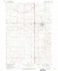
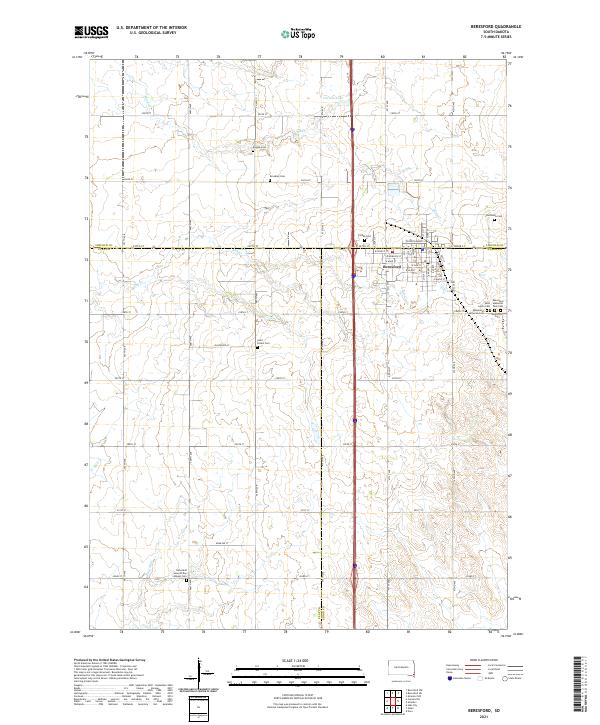
Beresford serves as a central hub at the intersection of Lincoln, Union, and Clay counties in this recent survey. The town's grid is clearly defined by streets such as W Main St and E Cedar St, surrounded by a landscape of productive agricultural land. For those interested in family history, the map provides an exceptional level of detail regarding local burial sites. Numerous small cemeteries are scattered throughout the rural sections, including Bonine Cem, Brooklyn Cem, Larsen Cem, and Bethesda Cem. The southern reach of the quadrangle includes the Danefield Seventh Day Advent Cem, while the eastern outskirts of town feature a dense cluster of memorial sites like Saint John's Cem and the Beresford Memorial Park Cem. Water drainage patterns are marked by the meandering paths of Blind Cr, Ash Cr, and Baptist Cr, flowing through the township blocks of T96N and T95N.
Find a feature on this map
41 named features on this map. Tap any name to fly to it.
Don’t see what you’re looking for? This feature index may not catch every label — zoom into the map to look around manually.
Map Details
Editions of this 2021 Beresford Map
This is the sole edition of this map. No revisions or reprints were ever made.