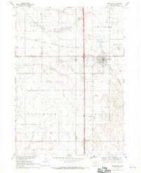
1968 Map of Beresford
USGS Topo · Published 1971About this map
Beresford serves as the primary hub on this late-1960s survey, situated where the Chicago and North Western rail line cuts across the prairie landscape. The area is defined by its rural community structure, organized into townships like Brooklyn, Pleasant, Glenwood, and Prairie. For genealogists, the map is remarkably detailed, locating several country schools including Brooklyn Sch and Danefield Sch, alongside numerous local burial grounds such as St Peters Cem and the Adventist Cem. The transition of the era is evident in the modern infrastructure of the Irene-Beresford Interchange and the Alcester-Wakonda Interchange, which contrast with older landmarks like Brooklyn Ch and the Bethesda Home. The drainage of the Missouri River Basin is traced through Ash Creek and Baptist Creek, illustrating the agricultural layout of the Clay, Lincoln, and Union County borders.
Find a feature on this map
33 named features on this map. Tap any name to fly to it.
Don’t see what you’re looking for? This feature index may not catch every label — zoom into the map to look around manually.
Map Details
Editions of this 1968 Beresford Map
This is the sole edition of this map. No revisions or reprints were ever made.
Other maps of this area

1897 · Canton
USGS Topo · 1:125,000

1898 · Elk Point
USGS Topo · 1:125,000

1900 · Canton
USGS Topo · 1:125,000

1901 · Elk Point
USGS Topo · 1:125,000

1907 · Elk Point
USGS Topo · 1:125,000

1955 · Sioux City
USGS Topo · 1:250,000

1955 · Sioux Falls
USGS Topo · 1:250,000

1958 · Sioux City
USGS Topo · 1:250,000

1958 · Sioux Falls
USGS Topo · 1:250,000

1959 · Sioux City
USGS Topo · 1:250,000