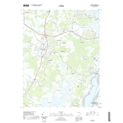
2019 Map of Berlin
USGS Topo · Published 2019About this map
The town of Berlin serves as the inland anchor for this Worcester County landscape, where the coastal plains meet the labyrinthine waterways of Newport Bay and Assawoman Bay. The area is defined by its numerous necks of land, including Turville Neck, Sinepuxent Neck, and Golden Quarter Neck, which reach out into the marshes and creeks. Significant genealogical interest is found in the distribution of family-named burial sites such as Evergreen Cem, Tyree Cem, and the Buckingham Presbyterian Cem.
Find a feature on this map
176 named features on this map. Tap any name to fly to it.
Don’t see what you’re looking for? This feature index may not catch every label — zoom into the map to look around manually.
Map Details
Editions of this 2019 Berlin Map
This is the sole edition of this map. No revisions or reprints were ever made.
Other maps of this area

1901 · Snow Hill
USGS Topo · 1:62,500

1901 · Green Run
USGS Topo · 1:62,500

1901 · Ocean City
USGS Topo · 1:62,500

1902 · Pittsville
USGS Topo · 1:62,500

1938 · Green Run
USGS Topo · 1:62,500

1942 · Ocean City
USGS Topo · 1:62,500

1942 · Ninepin
USGS Topo · 1:24,000

1942 · Ocean City
USGS Topo · 1:24,000

1942 · Tingles Island
USGS Topo · 1:24,000

1942 · Wesley
USGS Topo · 1:24,000