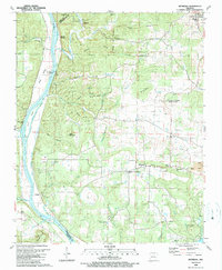
1989 Map of Bethesda
USGS Topo · Published 1989About this map
The White River carves a sharp path through this late-twentieth-century landscape, framing the agricultural and ecclesiastical heart of western Independence County. The settlement of Bethesda serves as a central hub, flanked by the Bethesda Campground and several rural congregations including New Hope Ch and Pilgrims Rest Ch. To the north, the terrain rises into the highlands of Waugh Mtn and Pilgrim Ridge, where narrow hollows like McDermon Hollow and Pine Hollow indicate a landscape dominated by timber and small-scale farming.
Find a feature on this map
70 named features on this map. Tap any name to fly to it.
Don’t see what you’re looking for? This feature index may not catch every label — zoom into the map to look around manually.
Map Details
Editions of this 1989 Bethesda Map
This is the sole edition of this map. No revisions or reprints were ever made.
Other maps of this area

1890 · Batesville
USGS Topo · 1:125,000

1891 · Batesville
USGS Topo · 1:125,000

1942 · Bethesda
USGS Topo · 1:24,000

1942 · Jamestown
USGS Topo · 1:31,680

1942 · Almond
USGS Topo · 1:31,680

1942 · Batesville
USGS Topo · 1:31,680

1942 · Mt Pleasant
USGS Topo · 1:31,680

1943 · Sandtown
USGS Topo · 1:24,000

1943 · Batesville
USGS Topo · 1:24,000

1953 · Memphis
USGS Topo · 1:250,000