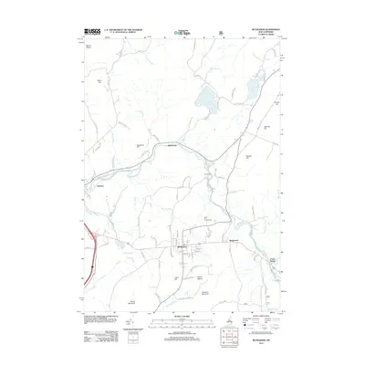
2012 Map of Bethlehem
USGS Topo · Published 2012About this map
The Ammonoosuc River winds through this New Hampshire mountain landscape, serving as a primary corridor for early transit and settlement. The town of Bethlehem sits at the heart of the map, flanked by several smaller historic communities such as Maplewood and Pierce Bridge. The local road network, including Miller Rd and Harriman Rd, connects these valley settlements to higher terrain features like Mount Agassiz and Cleveland Mountain.
Find a feature on this map
95 named features on this map. Tap any name to fly to it.
Don’t see what you’re looking for? This feature index may not catch every label — zoom into the map to look around manually.
Map Details
Editions of this 2012 Bethlehem Map
This is the sole edition of this map. No revisions or reprints were ever made.
Other maps of this area

1900 · Whitefield
USGS Topo · 1:62,500

1929 · Moosilauke
USGS Topo · 1:62,500

1929 · Franconia
USGS Topo · 1:62,500

1931 · Littleton
USGS Topo · 1:62,500

1932 · Franconia
USGS Topo · 1:62,500

1932 · Littleton
USGS Topo · 1:48,000

1932 · Moosilauke
USGS Topo · 1:62,500

1935 · Littleton
USGS Topo · 1:62,500

1935 · Whitefield
USGS Topo · 1:48,000

1938 · Whitefield
USGS Topo · 1:62,500