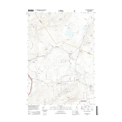
2015 Map of Bethlehem
USGS Topo · Published 2015About this map
Bethlehem sits at the heart of this landscape, flanked by significant peaks and water bodies that have shaped the region's development. The Ammonoosuc River and its various tributaries, such as Baker Brook and Barrett Brook, drain the highlands where summits like Mt Agassiz and Cleveland Mtn rise above the valley. To the south, the boundary of the White Mountain National Forest marks a transition into protected wilderness, while the northern reaches features several notable lakes, including Forest Lake and Burns Pond. Historical settlement patterns are evident in the clustering of neighborhoods like Apthorp, Maplewood, and Pierce Bridge along the primary travel corridors. The varied elevation, from Mt Misery in the northwest to Garnet Mtn in the southwest, illustrates the challenging topography that influenced the placement of Littleton Rd and other local thoroughfares.
Find a feature on this map
109 named features on this map. Tap any name to fly to it.
Don’t see what you’re looking for? This feature index may not catch every label — zoom into the map to look around manually.
Map Details
Editions of this 2015 Bethlehem Map
This is the sole edition of this map. No revisions or reprints were ever made.
Other maps of this area

1900 · Whitefield
USGS Topo · 1:62,500

1929 · Moosilauke
USGS Topo · 1:62,500

1929 · Franconia
USGS Topo · 1:62,500

1931 · Littleton
USGS Topo · 1:62,500

1932 · Franconia
USGS Topo · 1:62,500

1932 · Littleton
USGS Topo · 1:48,000

1932 · Moosilauke
USGS Topo · 1:62,500

1935 · Littleton
USGS Topo · 1:62,500

1935 · Whitefield
USGS Topo · 1:48,000

1938 · Whitefield
USGS Topo · 1:62,500