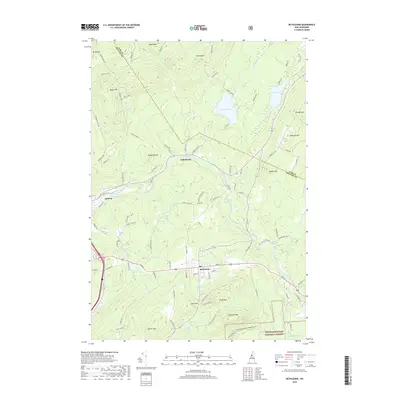
2018 Map of Bethlehem
USGS Topo · Published 2018About this map
The Ammonoosuc River carves through the center of this landscape, connecting the small settlements of Apthorp, Alderbrook, and Bethlehem. This 2018 survey reveals the residential and recreational character of the region, where the town of Bethlehem sits on a high plateau flanked by Mt Agassiz and Lewis Hill. To the south, the boundary of the White Mountain National Forest encompasses the peaks of Garnet Mtn and Cleveland Mtn, marking a transition from town life to protected wilderness.
Find a feature on this map
97 named features on this map. Tap any name to fly to it.
Don’t see what you’re looking for? This feature index may not catch every label — zoom into the map to look around manually.
Map Details
Editions of this 2018 Bethlehem Map
This is the sole edition of this map. No revisions or reprints were ever made.
Other maps of this area

1900 · Whitefield
USGS Topo · 1:62,500

1929 · Moosilauke
USGS Topo · 1:62,500

1929 · Franconia
USGS Topo · 1:62,500

1931 · Littleton
USGS Topo · 1:62,500

1932 · Franconia
USGS Topo · 1:62,500

1932 · Littleton
USGS Topo · 1:48,000

1932 · Moosilauke
USGS Topo · 1:62,500

1935 · Littleton
USGS Topo · 1:62,500

1935 · Whitefield
USGS Topo · 1:48,000

1938 · Whitefield
USGS Topo · 1:62,500